
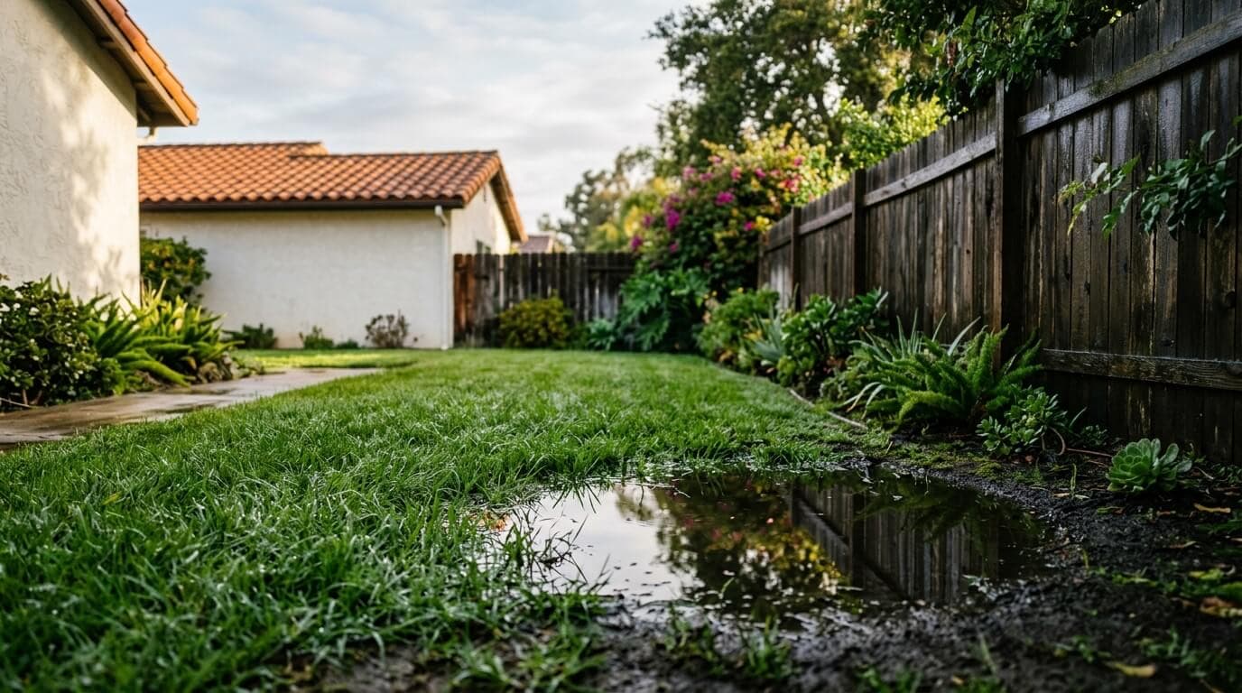
A backyard still soft three days after a storm is not a mystery about water — it is a question about a route. Where is the water on that lot supposed to go, what is stopping it, and which of the three usual remedies will the ground and the city's code actually allow? Menifee is unusually well documented on all three. Its grading regulations set out where lot drainage is meant to run and fix the line above which the work needs a permit; project filings made to the city describe what the ground does with water at depth; and the housing stock splits into eras graded under different rules. This works from those, then compares grading correction, catch basins and a French drain as they apply here.
A strong El Niño is forecast for this winter, which makes the route worth checking early. The El Niño winter guide covers what the forecast says and the checks worth doing before the rain. For a yard that is about to get a pool, patio or slab, what to settle first covers the planning side.
Soggy backyard in Menifee? Describe where the water collects.
Three Menifee lot situations a soggy backyard splits into
Most Menifee lots were laid out recently and to a plan, so the first step is to place the lot in one of three situations — each of which points to a different remedy. Census ACS 2019–2023 five-year estimates count 37,247 housing units citywide: 19,310 of them from 2000 onward, and 4,224 from before 1970.
- Post-2000 tract lot. The drainage route was designed before the house existed, so a wet backyard is usually an interrupted route rather than a missing one.
- Pre-1970 lot. The question is more often whether a designed route was ever there at all.
- Western high-ground lot. USGS 3DEP sampling puts Sun City near 1,424 feet and the central valley floor near 1,441, against Quail Valley points sampled at roughly 1,474, 1,535, 1,553 and 1,589. A valley-floor yard deals with water that arrives and sits; a high-ground yard also deals with water moving through the slope above it.
Key takeaway: Which of the three a lot belongs to — new tract, pre-1970, or western hillside — decides most of what follows. Establish it before choosing a fix.
What the ground under a Menifee lot is documented to do
Filings made to the City of Menifee are consistent about one thing: this ground cannot be relied on to carry water away at depth. Three separate documents say so:
- The hydrology report for Tentative Tract Map No. 38683 places its site in Hydrologic Soil Group D, the class reserved for the lowest infiltration rates.
- The Menifee Valley Specific Plan environmental document states its site "will consist of compacted fill over shallow dense formational soils with very low permeability."
- A geotechnical study at a residential site returned roughly 0.6 to 0.9 inches per hour at five feet, falling to 0.0 at ten.
Each figure is site-specific, not a citywide property. Together they establish that a design assuming the ground will swallow collected water cannot be assumed to work here without a test on the particular parcel. That removes a class of remedy before the comparison even starts: anything that stores water in a buried void and lets it leave through the sides and bottom — a dry well, a soakaway, an infiltration pit — depends on the one behaviour these filings say may be missing.
Key takeaway: On documented Menifee ground, buried-storage fixes (dry well, soakaway, infiltration pit) can't be assumed to work. What remains are designs that move water to a discharge point — which is why yard drainage in Menifee is usually about routing, not absorption.
The route the code expects, and the corridor it depends on
Menifee's code is explicit about where lot water goes: from the backyard, through the side yard, to the street. Two provisions set it:
- Section 7.90.220(F)(1) requires each lot to be graded so stormwater runs from the rear yard, through the side yard and front yard, and out to the abutting street wherever feasible.
- Section 7.90.220(D) requires drainage facilities to deliver runoff to the nearest practicable drainage way approved by the City Engineer or Public Works Director, and to prevent erosion where it discharges.
The corridor that route depends on is the strip beside the house, and Section 7.90.210 protects its width as well as its direction: a usable side yard of at least five feet from any building wall to the top or toe of a slope, with that setback reducible to a five-foot minimum only where an approved drainage device is used. Five feet is not much room, and it is shared with gates, condensers, meters and the slope itself.
So the common failure is narrow and physical — the route exists on paper, but something sits in it:
- A patio slab poured to the fence line.
- A raised planter across the corridor.
- Added soil that lifted the side yard above the backyard.
- A gate threshold set proud of grade.
Any of these turns a designed path into a dam, and the yard upstream of it holds what the path was meant to carry.
Key takeaway: A Menifee backyard usually floods because the coded backyard-to-street route through the five-foot side yard is blocked, not because it never existed. Finding the blockage is a different task from looking at the puddle.
Grading correction: what the code lets you move
Where the route is interrupted rather than absent, the fix is to restore it — the work of grading and drainage correction in Menifee — and two code provisions bound how far it can go.
Section 7.90.220(F) bars runoff from flowing over cut or fill slopes steeper than five to one. On a lot with a manufactured slope behind it, that forecloses the shortest apparent fix — tipping the lawn at the rear slope and letting it sheet over the crest. What the ordinance leaves is interception above the crest, the water carried off in a pipe or lined channel, which is a collection problem rather than a grading one.
Section 7.90.250 is narrower but telling: where expansive soils occur within four feet of finish grade in a building location, foundations are designed to the current California Building Code unless the project geotechnical engineer provides removal and stabilisation recommendations. It applies to building areas, not lawns, but it shows the city's posture — near-surface soil behaviour is a design input to handle explicitly, not something to reshape around.
Key takeaway: Grading correction is the right fix when there is fall to recover and a legal route to recover it into. It is the wrong fix when the only downhill is a slope steeper than 5:1, or when the water is not on the surface at all.
Catch basins and a piped run: the low point you cannot regrade away
When a lot has one or two fixed low points that cannot be raised — a sunken lawn panel, the inside edge of a patio, the base of a step-down — the answer is to accept the low point and pipe it out. The newer developments here do exactly that at their own scale: the Tentative Tract Map No. 38683 hydrology report collects lot runoff in catch basins with filter inserts and delivers it to a bioretention and detention basin sized against that site's Hydrologic Soil Group D rating.
A backyard version borrows the collection logic, not the disposal logic. A basin on a residential lot is the head of a conveyance line, and Section 7.90.220(D) is what the far end must satisfy: the run has to reach a drainage way the city accepts. For most Menifee tract lots that endpoint is the curb line in front of the house. Two things follow: the outlet elevation, not the puddle, sets the depth of everything upstream; and a basin installed with nowhere to go is a hole that fills — the exact failure the soils filings predict.
Point collection is right when the low spot is fixed, the water is on the surface, and an outlet with fall exists. It is wrong when the ground stays saturated after the surface has drained.
A French drain: when the water is in the ground rather than on it
The case neither regrading nor a surface basin addresses is water arriving from below or through the soil. In its Quail Valley findings, the Santa Ana Regional Water Quality Control Board named high groundwater, poor soils and shallow impermeable strata as the causes of the septic failures there — the same conditions that keep ground wet with nothing standing on it. On ground like that, a trench fills from the surrounding soil as well as the surface, so interception and fall matter more than surface shaping.
What the trench is for is the local distinction. Given what the Menifee filings describe at depth, French drain installation in Menifee works as conveyance — intercept, then carry to an approved discharge — not as disposal into the surrounding ground. Outlet elevation governs the design, and a subdrain on a lot with no available outlet is a different question, not a smaller version of the same one.
A subdrain is right when the yard is wet without standing water, when wetness returns without rain, or when seepage shows at the toe of a slope. It is wrong when the problem is a blocked surface route, which is quicker to see and simpler to fix.
Which of the three a Menifee lot indicates
| What the lot shows | Indicated remedy | What would change the answer |
|---|---|---|
| Post-2000 pad lot, water spread across the flat, side-yard corridor blocked by hardscape, added fill or a raised bed | Restore the coded route: backyard → side yard → front yard → street | No recoverable fall between the wet area and the street; then collection and a piped run |
| Fall generally intact but one fixed low point holds water after the rest drains | Point collection into a conveyance line reaching an approved drainage way | Outlet elevation too high to give the line fall; then the grading question reopens |
| Ground saturated with nothing standing; wetness returns without rain; seepage at a slope toe on the western high ground | Subsurface interception, sized on outlet elevation and fall | An intact surface route that was never checked; check it first |
| The only downhill direction is across a cut or fill slope steeper than 5:1 | Interception above the slope, carried in a drain | Nothing — Section 7.90.220(F) forecloses sheeting runoff over it |
| Any of the above where the proposed design ends in a buried pit rather than an outlet | None of the three as drawn | A parcel-specific infiltration test showing a usable acceptance rate at the depth proposed |
| Pre-1970 parcel with no evident designed route | Establish a route first; device selection follows | Discovery of an original drainage plan for the parcel |
The table keys on lot condition and outlet availability, not on what the puddle looks like. Two Menifee yards with identical standing water can sit in different rows.
Not sure which fix your Menifee backyard needs? Talk it through.
What needs a Menifee grading permit, and what does not
The permit line is lower than most people expect, and one condition on it explains many soggy backyards. Section 7.90.030 requires a permit to grade, clear, brush or grub previously undisturbed land, and to place or remove more than 50 cubic yards of earth material. The exemptions that matter to yard work:
- An excavation not over 50 cubic yards that is less than two feet deep, or that creates no cut slope over five feet high and steeper than 2:1.
- A fill not over 50 cubic yards, less than one foot deep, on natural grade flatter than 5:1, that does not obstruct a drainage course.
- A fill less than three feet deep, not supporting structures, not over 50 cubic yards, that does not obstruct a drainage course.
Both fill exemptions carry that same last condition. A raised bed or a pad of imported soil sitting across the side-yard route is not a small exempt fill — it is a fill obstructing a drainage course, which is also the most common way a Menifee backyard becomes soggy in the first place.
Two further provisions sit around this:
- Section 7.90.280 requires projects that disturb one or more acres to obtain state construction general permit coverage before the grading permit issues — a threshold a single backyard sits well below, but which explains why a subdivision's drainage arrives with paperwork a backyard's does not.
- Section 7.90.200 makes a drainage device that endangers adjacent property a hazardous condition and a public nuisance, with the owner responsible for mitigation. A drain aimed at a neighbour's lot is a category the code already names.
Standing water has its own listing. Section 11.20.020 declares as prohibited public nuisance conditions both land whose configuration causes surface water drainage problems of such magnitude as to be injurious, and unsanitary or unhealthful standing water likely to harbour mosquitoes and other vectors.
Key takeaway: Small regrading often stays under the Section 7.90.030 permit thresholds — but a raised bed or imported-soil pad across the side-yard route is a "fill obstructing a drainage course," which is not exempt and is a common cause of the flooding itself. Whether a specific scope clears the line is the City of Menifee's call.
Preparing for a drainage assessment of the lot
The city's own inspection rules are a useful guide to what matters, because they show what Menifee looks at when drainage is built under permit. Section 7.90.290 inspects drainage devices — concrete and gunite structures, subdrains, storm drains and earth swales — as their own items at stages, requires at least 24 hours' notice before work is ready for inspection, and holds rough grade until geotechnical and compaction reports are approved.
Scaled to one backyard, that is a checklist of what to have ready and mark before an assessment:
- The discharge point. Where the lot meets the street, and whether the side-yard route to it is continuous. The outlet governs the invert of everything upstream, so it is settled first.
- The corridor. Where the building wall sits relative to any slope, and whether the five-foot usable side yard is actually clear.
- The interruptions. Every slab, planter, footing, gate threshold and imported-soil pad between the wet area and the street, noting which were added after the house was built.
- The parcel paperwork. A tract grading plan, a soils or geotechnical report, or a drainage plan answers questions about the designed route that no amount of surface-looking will.
- Dry-weather behaviour. Whether the wet area returns without rain, and whether anything seeps at a slope toe — the test that separates the subsurface case from the surface case.
- Utility locates. Marked before any trench line is discussed.
Key takeaway: An assessment turns on the route, the outlet and the interruptions — not the puddle. Establishing those three is what the three-way comparison above actually depends on.
Get yard drainage help in Menifee
If the water on your Menifee lot is already a problem, these pages cover the work: yard and landscape drainage in Menifee, French drain installation in Menifee, grading and drainage correction in Menifee and downspout and gutter drainage in Menifee.
FAQ
Does fixing backyard drainage in Menifee need a grading permit?
It depends on the earthwork, and Section 7.90.030 sets the thresholds:
- Excavation under 50 cubic yards, less than two feet deep, creating no cut slope over five feet high steeper than 2:1, is exempt.
- Fills under 50 cubic yards below one foot on natural grade, and fills under three feet not supporting structures, are exempt — but only where the fill does not obstruct a drainage course.
Whether a specific scope clears those lines is a determination for the City of Menifee, not an assumption to make from a description.
Can standing water in a Menifee backyard become a code issue?
It can. Section 11.20.020 lists as prohibited public nuisance conditions both land whose configuration causes surface water drainage problems of such magnitude as to be injurious, and unsanitary or unhealthful pools or standing water likely to attract or harbour mosquitoes and other vectors. Separately, Section 7.90.200 makes a drainage device that endangers adjacent property a hazardous condition and a public nuisance.
How close to a slope or a property line can drainage work sit?
Section 7.90.210 requires a usable side yard of at least five feet from any building wall to the top or toe of a slope, places lot lines at the tops of slopes wherever possible, and sets setbacks for slopes from the grading-permit-area boundary. It allows that setback to come down to a five-foot minimum where an approved drainage device is used, with roof gutters and downspouts possibly required. On a narrow tract side yard those figures are the constraint the layout must fit.
Does yard drainage work trigger a stormwater permit?
Section 7.90.280 attaches that requirement to projects that disturb one or more acres, which must obtain state construction general permit coverage before the grading permit issues. A single residential backyard is well under that threshold. It is worth knowing because it explains why a subdivision's drainage arrives with documentation a backyard's does not.
What does the city actually inspect on a drainage device?
Under Section 7.90.290, drainage devices are inspected as their own items rather than in a final walkthrough: concrete and gunite structures, subdrains, storm drains and earth swales, at stages during construction. The section also requires at least 24 hours' notice before work is ready for inspection, and holds rough-grade approval until geotechnical and compaction reports are accepted. On permitted work the drain is checked while it is open — the same reason the route and outlet are worth establishing before a trench is dug.